
What are metro Detroit’s safest (and most dangerous) communities for peds, cyclists, and drivers?
A new interactive map lets you view where traffic-related fatalities occurred in your community over the course of a decade.
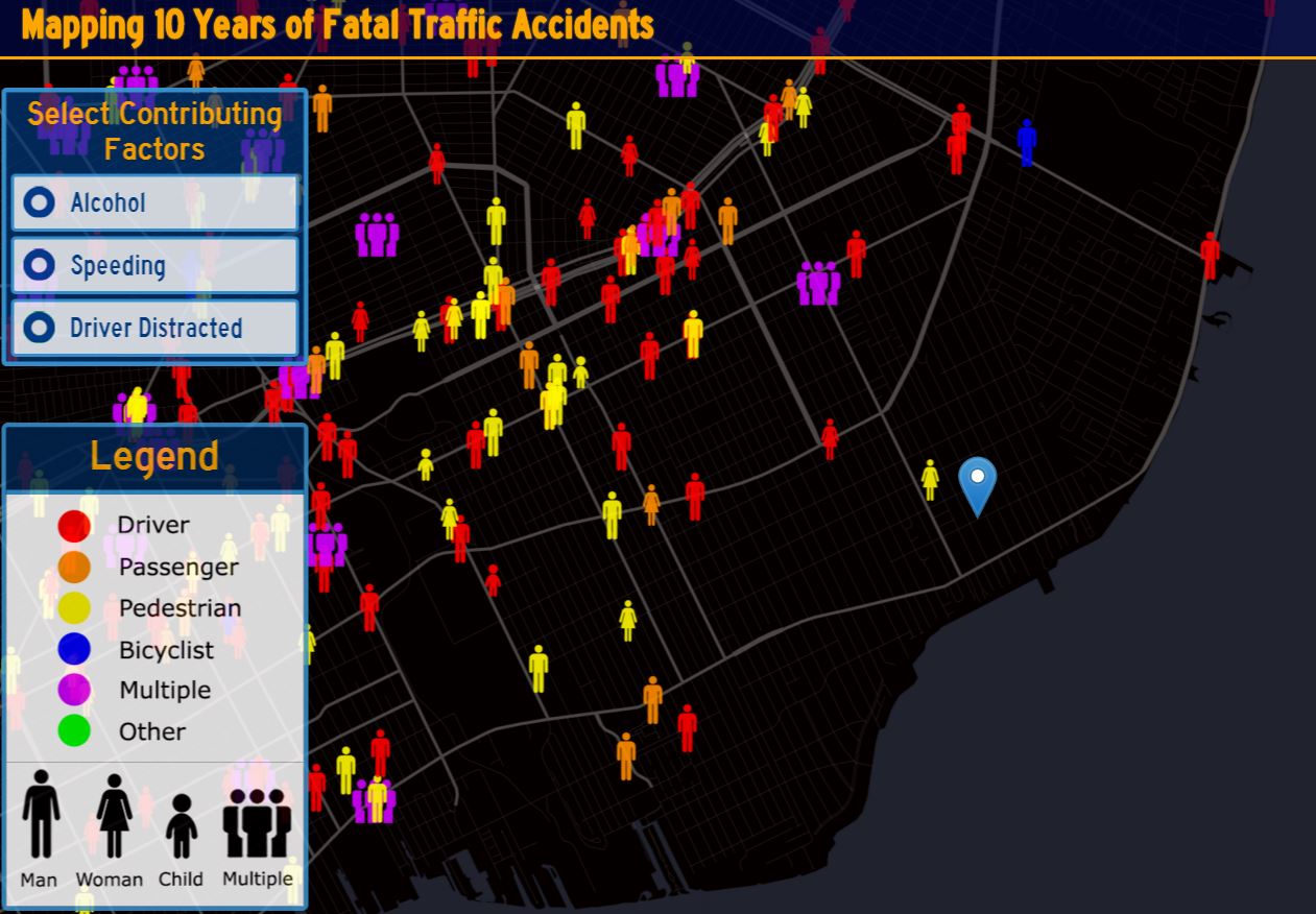
Between 2004 and 2013, 373,377 traffic-related fatalities occurred in the U.S. The data visualization blog Metrocosm recently published an interactive map that plots every single one of those deaths, showing the type of fatality (pedestrian, cyclist, or motorist) and the factors leading to each accident (distracted driving, alcohol, and speeding).
While the map does not break down data by municipality or jurisdiction, it does allow users to search by community. To see where traffic-related fatalities occurred in your neighborhood, type your address into the map’s search bar.
Click here to view the map.
Related Articles

From Code to Creation: LTU students and alumni bring games to life
As LTUX approaches on April 4, creators at different stages come together to showcase their work, navigate challenges, and turn ideas into playable worlds.

In Photos: Ferndale’s ‘Spring into Art’ highlights local artists for Art March
Metromode explored Ferndale’s Art March initiative by attending the “Spring into Art” event on March 20 that displayed paintings, sculptures and other media created by local artists.

Ferndale photographer gets international spotlight with nomination for People’s Choice Award
A Ferndale photographer is gaining international recognition for his macro photography. His photo, “Ready to Pounce,” showcasing the beautiful exotic ambush bug, is in the running for the global People’s Choice Award vote in the Wildlife Photographer of the Year competition.


